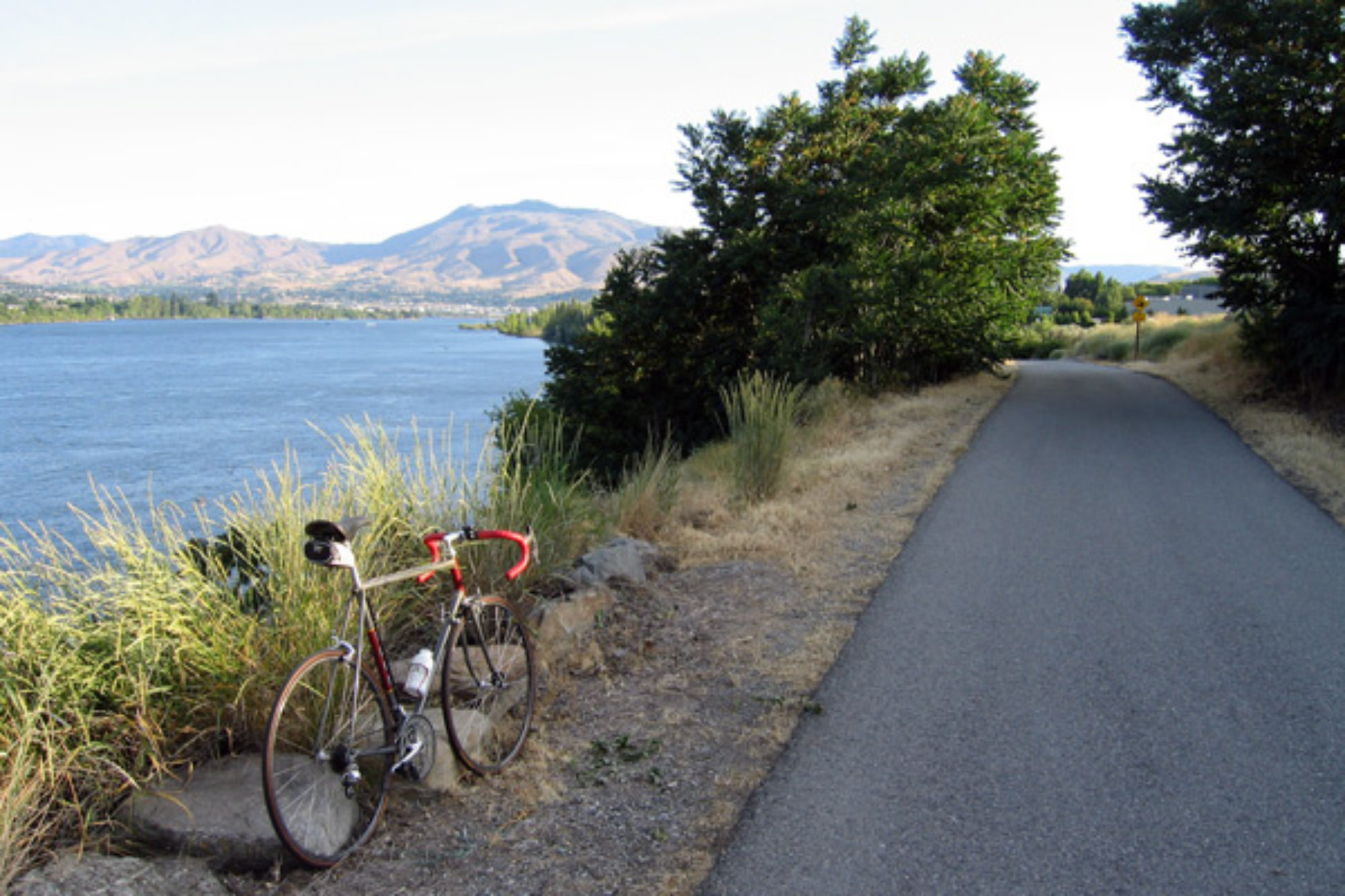
Day 41- Dinosaur Country

Today’s plan was simple. Ride to Jensen, Utah, take a shuttle to the Dinosaur National Monument visitor’s center, tour the fossil quarry, ride to Rangely, CO and camp. Easy.

The plan started to divulge almost immediately. In Jensen, I found out I had to ride 7 miles to the Monument visitor’s center. That would be an extra, unexpected 14 miles for the day’s ride. Next, I suffered my first flat tire of the trip. So getting that all behind me, I finally arrived at my the visitor’s center. Much later than I had planned.

But is worth it. The Dinosaur National Monument is cool.

In 1909, a fossil hunter found a few dinosaur bones. It turned to be an entire hillside littered with thousands of dinosaur bone fossils. Now the hill is covered under an entire building.

There are AT LEAST 1500 bones that are exposed inside the building. If you have any interest in paleontology this is a “must see”.

Now returning to the bike I pedaled back the 7 miles to the Hwy. By now, the temperature is nearing triple digits and it is the hottest part of the day so I am going to take a different tactic. First, I am only going to go as far as the town of Dinosaur saving 18 miles of riding. Second, I am taking refuge at a picnic area until 4:30 and letting the temperature drop to something more reasonable.

So at 4:30 I was rested and cooked off enough to proceed. But was still hot! I had to drink every 2 miles because my mouth would get so dry I felt my throat constrict.

About 3 miles from Dinosaur, I crossed into Colorado.

Way back in the 3rd or 4th day of the trip, I was riding with a local from Whidbey Island in Washington who was originally from Colorado. I mentioned that I had never cycled a single pedal stroke there. We both agreed that that was “just wrong”. That situation is now resolved!

In Dinosaur, I found a local cafe for dinner and then settled in to camp at the city park. Right in the middle of the play area on nice soft level wood chips. A softer camp site for sure. Hope the dinosaurs don’t get me tonight.

Day 40- Vernal, Utah

I felt a lot better this morning. I think the rest helped.

I talked to this person who said that my destination of Vernal, Utah was downhill. That sounded great to me. So off I went on another sunny morning.

So where was this “downhill”? All I did was mimic the up and down routine from the previous day. As a matter of fact, at one point I even set a new high altitude mark for the trip. 8428 feet ASL.

And still no significant downhill. This guy must have picked me for a rube or something. Downhill, downshmill.

After about 18 miles I found the downhill. 9 miles of 5-8% downhill. What a ride. I would even now make Vernal for lunch (and lunch is always important to me!).

Now only 5 miles from Vernal, I saw a sign for Steinaker State Park and there was a swimming icon on the road sign. Swimming sounded good, especially since the temperature was climbing fast at this lower altitude. Probably in the low 90’s already. So swimming it was, and lunch could wait!

The detour for swimming was worth it! And I still made it to Vernal at a reasonable time. Time enough to inquire at the Chamber of Commerce Visitor Information Center for a campground, bike shop and restaurants.

I bought new cycling gloves and a new hat. The guys at the bike shop also checked my tire pressure and lubed my chain for me. The tires are holding up well. They estimated I was at about half the life of my rear tire. The front is barely worn at all at this point. Not bad for 1994 miles. Yep, just not quite 2000 Miles. That will be official tomorrow but I am averaging right at 50 miles a day. Ok, for you math nerds, it is actually 49.85.

So now I am cooling my heels at the Vernal Brewing Company Pub. Big surprise, huh? A couple of beers, dinner, then off to the campground and a shower. Life is indeed good. Broken down to life’s basics, but good.

Day 39- Flaming Gorge: Day 2

The wind really howled last night so I had no idea what to expect for the day ahead.

When I awoke, the weather had settled down. No wind and sunny skies. I am feeling pretty tired from 8 days on the bike, but instead of a rest day, I decided to opt for a short, easier day. It would only be about 30 miles to Red Canyon and the choice of several campgrounds.

What a difference a day makes, or a State for that matter. I left the sage brush immediately after leaving Manila. And I was climbing. I guess one had to do with the other! I was entering the Red Canyon part of Flaming Gorge NRA. At Sheep Creek, I met some locals.

From there, it was uphill. A couple thousand feet uphill and I used ALL the gears including the small ring this time!

The sage turned to piñon pine, and as I climbed higher yet, to ponderosa pine forest. The day might have been shorter, but is was not easier! I kept waiting to get to the summit of my climb, but it only teased me. I would get to a downhill but would only last for a half mile and start climbing back up again. This went on for the entire morning and into the early afternoon. I really never got to a “summit” per se I think I spent most of the day over 8,000 feet, but there was no way to tell for sure.

I did however get to the Red Canyon overlook area. But I was really gased at this point. I went to the Red Canyon Lodge for lunch and then immediately headed for the campground. Then I did something I rarely do…… I took a nap! For 2 hours.

About 5:30 I rode out to the overlook area.

This part of Flaming Gorge really was spectacular, especially from 1700 feet above the reservoir. No sage brush in sight.

After viewing the gorge from the overlook, I headed back to the Red Canyon Lodge for dinner. Then it was off to the tent for an early night. So much for an easy day. But it was all worth the effort.

Day 38- Flaming Gorge

This morning is slightly overcast and dead calm. Perfect for riding!

Before leaving Green River, I went to the store to get more food and supplies. This country is too remote and you never know what can happen.

I had to climb out of Green River to the awaiting sage prairie, but it was a reasonable grade. Once on top, the pedaling was easy since the wind was not a factor this morning.

I was following the Flaming Gorge National Recreation Area. It is a big lake behind the Flaming Gorge dam about 40 miles to the south. Much like the Green River, I did not get to see it very often since it was in a gorge. Duh! I did take a short detour to one of the marinas and had lunch by the lake. It really wasn’t much to look at at this particular point. I am hoping that will change as I get further south.

Something happened right after lunch! A big weather cell was moving through the area and the wind changed and I bet you can guess which way it was blowing. Yes, right in my face. Any rapid progress I was making before came to a sudden stop. I really suffered for the last 15 miles.

Right outside of Manila, I stopped at a store to get a beverage. Just like that, the cell moved in, the sun came out and the wind quit. WTF? Oh well. Manila was my end point for the day. And remember what they say: Eat, Drink, and be Merry for tomorrow you may be in….

Utah! Yes, another new state. Manila is just 2 miles inside the state line.

I stayed at the KOA here. I took a nice hot shower and got to do laundry. Clean clothes. Fantastic.

Wyoming is in the rear view mirror now. I have to say that Wyoming was pretty nice to ride through. With only a few exceptions, the Hwy shoulder width was exceptional. 6 feet. The roads were in good condition and mostly the shoulders were pretty clean from debris. Now if they could just landscape the area to get rid of the sage brush and put some more towns along the way. Is that asking too much?

Day 37- The Middle of Nowhere

The calm from last night did carry over to this morning. Hopefully the wind would cooperate for the whole day because I would take any help I can get today.

There where NO towns on my route today until I would get to Green River, Wyoming 64 miles away. As far as I could tell from maps, there wasn’t much of anything.

They say that US Hwy 93 in Nevada is the loneliest Hwy in America. Wyoming Hwy 372 must be a close second. Just as I had surmised, there really was nothing but wide open spaces out there. No towns, no buildings, no real hills, no traffic. It followed the Green River, but you could rarely see it since it was down in a canyon below the line of sight.

Normally, I like to take at least an hour for lunch just get off the bike for a while. Today, I took a mere 15 minutes. With no real place to pull over and no shade, it made no since to sit around in the hot sun for very long as you can see from this photo of my lunch stop.

I had enough water for this ride but it was warm and I was getting pretty parched. Hwy 372 ended at it’s intersection with I-80 and I was hoping there was going to be a gas station there. No such luck. I would have to pedal the last 6 miles into Green River before I would be able to get a cold refreshment. Luckily, the road was mainly downhill so that was the end to a hard day. I said to myself, No Camping tonight. I am in a motel with AC, shower, and a bed.

A day like this is not really what you think about when you decide to undertake a bicycle tour. It is really important to keep in mind that sometimes you have to go from point A to B so you can get to your goal of point C! That is what today was. Point C will be more interesting in the next few days. Flaming Gorge National Recreation Area, Dinosaur National Monument, and the mountains of Colorado are ahead. Plus, it is probably good mental practice for the Midwest in the next month.

Just a quick note to everyone: Carl Stivers is a co- administrator for my blog site and I appreciate that he posted some viewing data in his comments. I am so amazed that so many people are following me on this trip. I feel extremely fortunate that I have so many friends who take the time to read the blog and offer comments. Thank you everyone!

Day 36- The Green River

The wind blew all night! When the wind blows, cyclists wonder (and worry) that it might be a nasty headwind to have to deal with.

Somehow, the wind died down right as I was getting ready to shove off for the day. The sky was clear so it might be a good for riding.

After I climbed “the rim” yesterday, I crossed from the Snake River drainage to the Green River drainage. I crossed the river several times during the mornings riding. It is supposed to be a classic trout river but I have never fished it. Maybe someday on another trip.

The Green River also has a lot of history too. It was a main area for the fur trade and the famous mountain men that we gave all heard about from school and movies. They would trap beaver and such and then have these big gatherings to trade. One such gathering place is called Names Hill. It is called that because the members of the gathering all carved their names into the side of the hillside. One of the names was “Jim Bridger- Trapper 1844”.

As I was entering the town of Marbleton, I was flagged down by a motorist with a Utah license plate. This guy, Rupert was an avid cycling tourist and wanted to know if I needed any supplies. He was just returning from a backpacking trip in the nearby Wind River Mountains. I took a couple Cliff Bars but turned down this massive bag if trail mix. It was just too big. Next we were talking about my route and Rupert had cycled almost every mile of my route through Colorado. We ended up having lunch so I could pick his brain some more and he gave me lots of good ideas on altering my route plan.

Once back on the road, the wind had picked up and it was clouding up a bit. The wind was mostly a side wind so it did not impede my progress much. Every now and then it turned into a headwind or tailwind depending on the twists and turns of the road. All in all, not a bad day of riding.

I was planning on camping at Fontenelle Reservoir which is part of the Green River. I knew there were a few campsites but I wasn’t sure where they were. I stopped at this historical market along the road to get my bearings and noticed I had a new text message. It was from Rupert and he had scouted the camping options for me and texted me the mileage from the exact point I had stopped at. Another amazing act of kindness from a complete stranger.

I picked the furthest campground to take a few miles off tomorrow’s ride (it was going to be a challenge).

The réservoir offered a break from the sage brush that has dominated the recent landscape. It was dead calm as I retired for the night. Hope it carries forward to tomorrow. At least I did not gave to listen to the wind and worry about it all night.

Day 35- The High Chapperal

This morning was another “blue bird sky” day. Not a cloud in sight. Being so close to the river also brought a heavy dew and my tent was soaked. I would not be getting an early start today waiting for everything to dry out.

Having no guide maps, today was a bit of a mystery as to what I would be riding today. All I knew for sure was that I would ride out of the Hoback River Canyon and that the Wyoming Hwy map said that I had to ride up to “The Rim”.

Riding through the canyon continued to be great riding. The river is a classic trout river and the surroundings are timber lined. Worthy of a trip if anyone is ever in this part of the world!

After about 10 miles I found out what the rest of Wyoming might be like. Sage brush prairie. Lots of sage brush!

The first “town” was Bondurant. I don’t think I saw a living soul as I rode through. I had planned on getting some food and water for the rest of the day since I still had 32 miles to go to Daniel, Wyoming and it appeared that there wasn’t any towns until Daniel. Just as I was giving up hope, I came to a small diner about 5 miles out of Bondurant. Thank goodness.

Now fueled up and topped off with water I began the climb to “The Rim”. It was a long steady climb but not too steep until the last mile or so and even then I still did not need the small chain ring (which I haven’t even used since Washington). The upper portion of the Rim offer a brief respite from the sage.

Once at the top, it was clear sailing to Daniel. Downhill for nearly 10 miles ….. and a tailwind! I arrived in Daniel around 2:45. Daniel was not what I expected though. It was more of a Hwy junction than a town. All there was was a gas station, a restaurant, a convenience store, a bar, and an RV Park. Check, check, check, and check. I would stay here for the night. Seeing as there ins’t much to do in Daniel, I think I stayed in the bar for about 3 hours having food and beer. I even had a Drambuie for dessert!

I met lots of interesting people. I learned about guiding on the Green River from some fishing guides and about the big Mountain Man Rendezvous event in nearby Pinedale.

I also met a family passing through. The Gregersons. They asked about my trip. They were from Grand Junction so I asked them about the route and road conditions since I was headed that way. They said that they really hadn’t ever looked at the road from a bicyclist perspective before but they offered to take me out to dinner when I got there. I said that wasn’t necessary but we exchanged contact information “just in case”.

Later in the evening I started getting these text messages from the Gregerson’s with incredibly detailed recon about the road to Grand Junction. They would send me info for each stretch of road as they passed through it. It was fantastic. Road and shoulder width, pavement condition, traffic volume, and even where I would need extra water. I think I am ready for that stretch when I get there in a few days now. Thank you to the Gregersons. I will most certainly look them up when I get there!

Day 34- Jackson Hole

There was some excitement in our campground yesterday. A black bear decided to take a stroll through the campground. He did not cause any issues, but most of all, I did not get to see him. Drat. I like bears (from a safe distance of course).

This morning, I would venture further into Grand Teton NP. There was a scenic loop to take going past Jenny Lake that even had a bike path. That was nice. Plus, the Tetons kept getting bigger and closer as I went.

I got some cookies and a coke at the Jenny Lake Visitor’s Center. I also found out there was a 21 mile bike path from the visitor’s center all the way into Jackson. Separate bike paths are the best thing ever, at least for cyclists. It was primarily downhill too. I only had to deal with a pesky headwind.

Just before Jackson, the path (and Hwy) come to the National Elk Refuge. Cycling along the boundary I saw ……. zero elk. Oh well.

In Jackson, I had to do some errands. First of all, I needed to find a bike shop. I had been hearing a rattle on my bike for the last few days and finally figured out that my water bottle cage had broke. So a new one was task one.

Next, I needed to go to the Forest Service office to get some information on campgrounds. I think I have previously mentioned that I had been following the Adventure Cycling route maps. Today, I was going to be venturing off the route. I did this way back after Glacier NP, but this time it will be for about a month. I have the route planned, but my camping locations were still very uncertain. The people at the USFS really helped me out there. I feel pretty confident now about the next week.

So now, the only thing left to do in town was find some lunch and update this blog (which was about 3 days behind due to lack of any service at all). The Snake River Brewing company solved the last problem for me. I stayed there until 4:30 getting things caught up. Then it was on to the Hoback Canyon FS campground about 19 miles away. There was another bike path for the first 5 miles but it disappeared in the middle of a road construction project. After that a local bike commuter told me how to get onto the old Hwy which had virtually no car traffic on it. It involved riding on some gravel single track for a few hundred yards but well worth the effort. Then all that remained was 8 miles through the Hoback River Canyon which was a fantastic, beautiful ride.

The campground was really nice, right on the river. I paid for my spot and then started talking with a guy named Shane from Phoenix who was fly fishing the river. Low and behold, next thing I know he is getting his backup rod and rigging me up! We actually caught quite a few native cutthroat trout in about 45 minutes! What a great bonus to the day. Thank you Shane! Finally I had to quit since I had not even set up my tent yet and it was starting to get dark. Well, we have to have out priorités now don’t we. Fishing first, camp second.

Day 33- Grand Teton National Park

This morning, I woke up tired and I slept in a little bit, even for me. But up and at’ em i was eventually.

Today I was hoping for an easy day. Only 40 miles to Coulter Bay campground.

First, I had to leave Yellowstone NP. It was only 22 miles to the south entrance. Along the way, I unceremoniously crossed the continental divide for the 6th time. No sign. No nothing. You only knew by looking at the map.

I had lunch at the Flagg Ranch Resort just outside of the park. After lunch, it was a bit of a climb but then into Grand Teton National Park.

While Yellowstone NP has amazing geology and scenery, Grand Teton has majestic mountains!

The mountains tease you! They are an amazing sight from afar, but keep getting better as you get further into the park.

As hoped for, I arrived at the Coulter Bay campground around 2:30 and parked the bike there for the day.

I took a swim in Jackson Lake, enjoyed a very cold beer at the bar and then had dinner. All before 6:00. The short day was necessary after the last two days. I think I am back on track now. Time will tell.

Day 32- Yellowstone National Park

The morning brought hope of NO wind today. At least it was a possibility with the way the morning started.

The day also promised many new milestones to be met as well.

The morning got off to a good start with easy pedaling into West Yellowstone, MT. It was 24 miles but it went by fairly quickly. In “West”, i did a few errands like getting some food and checking the air in my tires. Then lunch.

After lunch, it was time to go into Yellowstone National Park.

There is a reason Yellowstone is the first National Park. It is full of wonderful things. I would not see the whole park since I have been here many times but I would stop at my favorite places though. But first, I met a milestone by leaving Montana and entered Wyoming. Leaving Montana is always bittersweet for me but the show must go on.

Now I had a minor dilemma. The first camp ground is at Madison Junction. That would only be a 38 mile day and seemed short. The next campground would not be until Grant Village and be a massive 75 mile day. I opted for the Grant Village camping.

First on my sight seeing agenda was the Grand Prismatic Spring.

The first people to ever see this must have been blown away. It seems to me that this could not really exist, yet it does right here in Yellowstone. Note: google it to see better aerial photos and you will see what I mean.

Next was the iconic Old Faithful geyser.

Now after 56 miles, I would have to head for Grant Village. And over the continental divide…… twice! And it was already 5:45 in the evening. I think it is going to be a long day.

After getting to Grant Village and getting my camp spot at 8:00, my day was still not done. I went to get some dinner at one of the village restaurants, then got a much needed shower and finally got back to my camp spot at 9:30.

It was a BIG day. A new daily mileage record, a new high elevation mark, a new NP, a new State, and crossed the continental divide for the 4th and 5th time. After two hard days, I was hoping for an easier day tomorrow.