Well, Steve left and now it was all up to me to make my own way forward.
The initial thing I wanted to do was to figure out the way to ride toward Albertville. This is to the northeast of Chambéry. I mentioned earlier that I had tried years ago to ride in that direction only to be forced onto a busy highway that left me uncomfortable to say the least. But, as Steve and I were driving toward Tignes and Val d’sere on one of our non-riding days, I noticed what appeared to be a bike path along the highway. There had to be way to get on that path from Chambéry! I just needed to figure it out! I started by looking at maps and using the internet to look for bike paths in the area. Et voila! If I started out in the general direction of Grenoble, I could detour into a village of Montmélian and connect to a bike path that was brand new to me. The trick is always getting through the village and typically is a trial and error thing, getting lost and backtracking until you find your way to the bike path. But finding the new route was worth it.
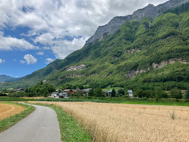
The path (chemin in french) was nice! And it was nice to again be exploring new routes around the area. At one point, the path did briefly merge onto a lightly traveled roadway, but I discovered something amazing, to me anyway!
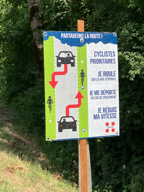
As you got onto the roadway, there was a sign directing vehicles to follow and not pass cyclists who were on the road! Cyclists are not on the road very long before they turn off again onto the dedicated bike path so it wasn’t a huge deal to motorists, but this amazed me. This was a first!
About that time, I was starting to get a little tired so I ventured off the bike path and pedaled up a fairly steep road to the hamlet of Saint-Pierre d”Albigny looking for a market or someplace to get a drink and maybe some food. But alas, no luck. So I went back toward the bike path but came out a little further down the path than where I left it. Riding backwards on the path, I almost immediately came to a snack bar that seemed a bit out of place.
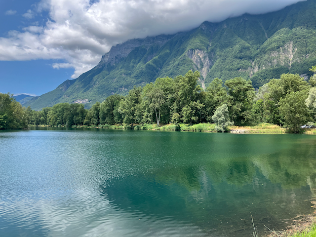
But I stopped there anyway and had a Coke and a sandwich. Afterwards, I started back to Chambéry but realized that the snack bar was part of a park. And the park had a nice looking lake. It appeared that cars had to pay an entrance fee, but bike were allowed to pass through the gate for free. Nice!
At that, I figured that was enough exploring for one day since I really had no idea where exactly I was in relation to Albertville and I wasn’t in very good cycling shape anyway. So back to Chambéry I rode, and I didn’t even get lost.
My next ride was a brief ride to Aix-Les-Bains, a ride I had done many times in the past. It travels a nice bike path until it comes to the lake which Aix-Les-Bains is next to, Lac Bourget. I turned around after that since it was only a training ride, trying to get into riding shape.
The next ride would serve more of a purpose. I would continue to explore the route to Albertville. I planned to ride past the first lake and find my way further toward Albertville. I had not made to yet to the portion of the bike path I had seen from the highway, so that would be the next goal for me. I rode past the first lake and tried to follow bike path signs. I was mostly successful, but there was some missed turns here and there. But eventually, success. The path came to the Isere river and then to the highway that went to Albertville. After crossing the river bridge and going under the highway, a quick left turn and I was on the path that I had seen! And it led to another lake. So I stopped.
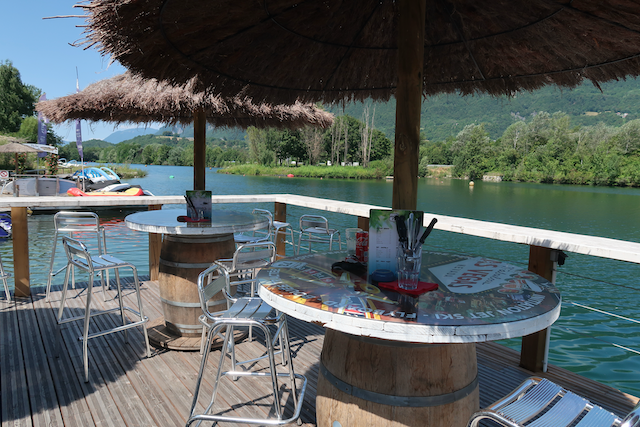
This lake was more of a boating lake where you could rent motorboats and such. No one was on the lake at this time so it was nice and relaxing sitting out on the deck enjoying a nice cold drink. But this too would be my turn around point. I did make it further than the previous ride, so I took that as a sign that my fitness was going in the right direction.
very pretty area of France. way to go finding your way around.